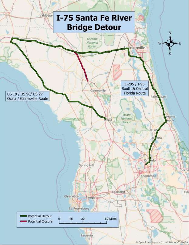
The Santa Fe River under I-75 has rapidly risen 15 feet within the past 36 hours due to the heavy rainfall over North Florida from Hurricane Irma. In the event that I-75 closes, please see the detour map below. Click to enlarge.
Additional bridges that may be impacted include: U.S. 27, U.S. 41, S.R. 47 and possibly U.S. 121. Additional maps and detour information will be forthcoming.
FDOT and FLHSMV have staff monitoring the bridges that may be impacted by the flooding 24/7. If the river rises to an unsafe level, the bridge will be impassable both northbound and southbound, and would be closed immediately. Floridians that are traveling should avoid the area if possible.
If required to be in the area, the Florida Department of Transportation is actively working with WAZE, Google Maps, the Georgia Department of Transportation and other transportation
industry partners to communicate the potential reroutes to the public.
For more I-75 travel info, visit www.i75exitguide.com, the Internet’s largest and most complete website devoted to I-75, America’s Interstate Main Street. Detailed exit service listings… discount lodging, camping, food, gas and more for every exit from Michigan to Florida! Plus I-75 construction, real-time traffic and road news.
Traveling another route? Visit our growing family of exit guides: I-4 Exit Guide, I-5 Exit Guide, I-10 Exit Guide , and I-95 Exit Guide.